Wednesday, November 8, 2017

Tarpon Springs Port Day

This blog will chronicle our (Pat and Patty Anderson's)
cruising adventures on the Great Loop!

DAY 219 - November 6, 2017

We slept in a bit and had a "Sunday breakfast" on a Monday! We walked over to the Chamber Office to clarify a few things about the Jolley Trolley schedule and pickup point on the Sponge Docks, which was right across the street from the marina.The Jolly Trolley is only $2.50 for seniors for an all day pass that allows you to get on or off as many times as you want. So at 11:00 a.m., we got aboard the Jolley Trolley!

The Jolley Trolley
The Coastal Route runs through the communities of Tarpon Sorings, Crystal Beach, Palm Harbor, Ozona, Dunedin, and Clearwater, with a transfer to the Beach Route for Clearwater Beach. The trolley was far different than we thought it would be because the stops were not a few blocks apart but in some cases miles apart.  The trolleys run about half an hour apart instead of every ten or fifteen minutes. We thought we might get off at the Publix Supermarket, which is a regular stop, but we decided just to enjoy the ride!

 We had not gone into downtown Tarpon Springs because it is really too far to walk from the Sponge Docks. Tarpon Springs has a population of 24,000, and there were a number of places we might have enjoyed like the Cultural Center and several museums, but they we all closed on the days we were there. If we were going to get off and explore one community, it would have been Dunedin, which is a community of about 36,000 but has a central downtown that has a really small town feeling. The Lay Association of the Free Church of Scotland, through a company called the Otago Association, founded Dunedin at the head of Otago Harbour in 1848 as the principal town of its Scottish settlement. The name comes from Dùn Èideann, the Scottish Gaelic name for Edinburgh, the Scottish capital. The Welcome to Dunedin sign and the City Hall prominently feature a piper! Clearwater is a larger city, with high rise buildings and a populations of about 115,000. Clearwater Beach looks like any resort town, with a Ron Jon Surf Shop and loads of small shops, restaurants, bars and hotels.  The trolley did not go into Ozona, but the rest of the route was essentially strip malls and fairly uninteresting.

We got back to the City Marina about 1:30 p.m. ready for lunch, so we walked over to Yianni's Greek Restaurant. We had the best gyros ever! The meat was ground lamb and beef, cooked on a vertical rotisserie and then sliced off in thin strips. Gyro means "turn," so it is essentially the same thing as doner kebap in Turkey. It was served with pita bread, onions, tomatoes and tzatziki. We had enough of the gyro meat left over for lunch the next day! This late, and filling, lunch presented a problem, since our reservations at Hellas were for 6:00 p.m. No way would we be ready to eat again at 6:00 p.m., so we changed our reservations to 8:00 p.m.

We spent the rest of the afternoon walking the entire length of the Sponge Docks on each side of the street! We poked our noses into many, many stores. Patty bought silk sponges for her pottery at Palm Creek in Arizona, some specialty lemon infused oilve oil, which is great over hummus, and small gifts for the grandchildren. I took a lot of photos of boats!

Typical retail display of sponges - we didn't buy any of these.
Specialty olive oils - we bouight the lemon infused olive oil in the middle.
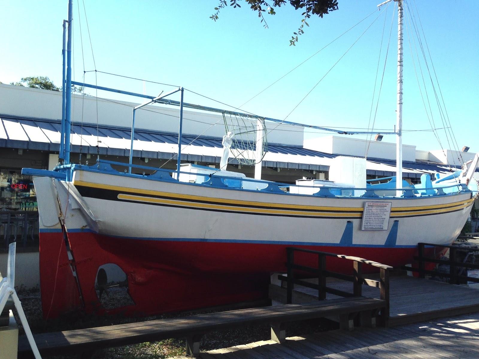
Sponge boat on display in courtyard
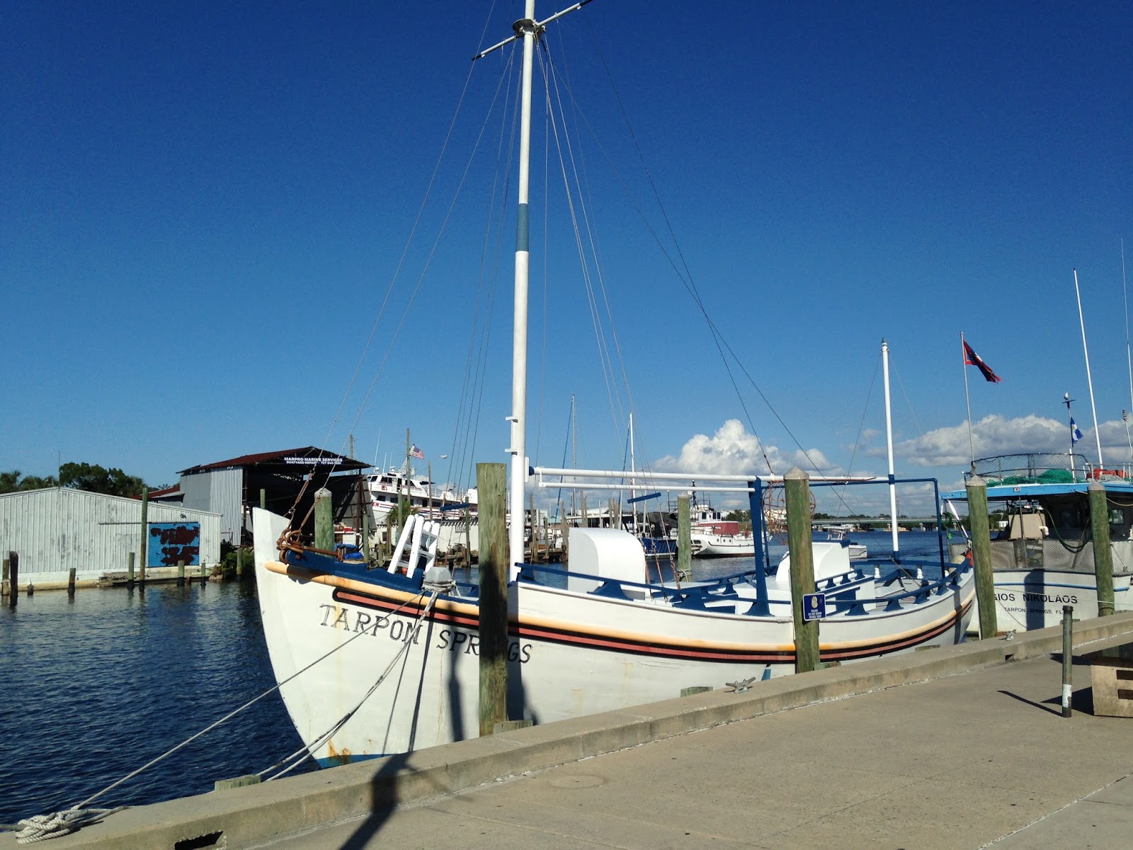
The Tarpon Springs sponge boat
Anclote River tour boat
We walked back to the marina with a bit of time on our hands before our dinner reservations. There was a bird on the gunwale of a charter fishing boat, and the Dock Master said he had been feeding in the boat's live well!

Well fed bird on gunwale of charter fishing boat
I wrote and published my blog for yesterday, and then eventually it was time to head for Hellas Greek Restaurant.

Hellas Restaurant
We each started with the lemon soup called avgolemono and a glass of white wine. The avgolemono was delicious, and we may need to get a recipe and start making it at home. Then things went downhill! I had ordered slices of leg of spring lamb and Patty had ordered tiropita, which is an assortment of cheeses baked in filo dough. The waiter soon returned to tell me that he was sorry that they had run out of the slices of lamb, and I needed to choose something else. A Greek restaurant that allows itself to run out of lamb? Not good.  So I chose the assorted cold plate, with octopus, shrimp, peppers, olives,  tzatziki, and a scoop of  taramosalata, a Greek meze made from tarama, which is salted and cured fish roe, and a scoop of skordalia, which is a potato and garlic dip. The octopus, shrimp, peppers and olives were good, but unfortunately, the assorted cold plate did not come with pita, which left me wondering exactly what I was supposed to spread the tzatziki, taramosalat and skordalia on, since none of these seems like something you would eat without pita. Patty's tiropita was one huge piece, when she had been expecting individual rolls, the way they are served everywhere else she has had them. Maybe the whole experience was colored by how good Yiannis had been, but we will probably not be recommending Hellas. Your mileage may vary!

We have enjoyed our day and a half in Tarpon Springs a lot, and again are really glad we elected to come in and stay at the marina instead of anchoring out at Anclote Key as we had originally planned to do. Our Loop is really winding down now, and the end is bittersweet, as Patty says. The Florida weather beats the snow back in Washington State by a mile, but we are both ready to go home!


Monday, November 6, 2017

Tarpon Springs!

This blog will chronicle our (Pat and Patty Anderson's)
cruising adventures on the Great Loop!

DAY 218 - November 5, 2017

We woke up at Bayport this morning in pea soup fog!   Although the clocks changed from daylight savings time to standard time, we were biologically still on daylight savings time, and got up an hour early.  Fog or not, Baxter still needed his shore trip, so I paddled to the boat ramp and back in the fog!

Pat and Baxter in kayak in the fog!
Just as we were coming alongside the boat in the kayak, I heard a loud splash near the shore, and glanced over. I'm pretty sure this was our first real alligator sighting! Even though everything we have read and heard about alligators is that they are shy, and usually don't bother people, I wasted no time getting Baxter and then myself back on the boat! Baxter rides in a very precarious spot, and a little dog in the water, or even in a kayak, might be a tempting snack for an alligator! We got the binoculars out and scanned the water near the shore, but did not see anything else.

Our friend Jonathan Arthur, who just completed his THIRD Loop on his 22 foot C-Dory Salty, called this morning because he saw we were at Bayport, and he wanted to urge us to cruise up the Wiki Wachee, which he says is one of his favorite rivers. He also asked where we would be staying in Tarpon Springs, and when I told him the City Marina, he was a bit down on it. He said the docks are lousy (or something like that) and there are a lot of people going by on the street. On the first count, yes, the docks are pilings and little fixed finger piers, and it has been exciting getting on and off the boat at low tide, when the finger pier is three or four feet above the boat, but we have managed. The Harbor Master says floating docks are coming next year - too late for us! On the second count, to us being right on the Sponge Docks, where everything is close at hand, is a big plus. They also have just completed a very nice private bathroom with a great shower for boaters. So all in all, we are not sorry we are here. It would have been a lot more difficult to do everything we did if we had been at a marina across the Anclote River!

The Chamber of Commerce Visitor Center occupies the other half of the marina office building, and the lady there was very helpful. We left with a fistful of maps and guides to the area, which we will probably look at more closely tomorrow morning. We also asked her which was her favorite Greek restaurant, and both she and the Harbor Master said without hesitation that it was Hellas, so we plan to have dinner there tomorrow.

Tarpon Springs City Marina and Chamber of Commerce Visitor Center
Tarpon Springs is known as the "Sponge Capital of the World." The City Marina is on Dodecanese Boulevard, and is at the start of the Sponge Docks, an area now mostly occupied by Greek restaurants, gift shops, specialty shops (tea, spice, olive oil), and lots of sponge shops. The waterfront now has mostly tour boats and charter fishing boats. The Sponge Docks are the historic home of the sponge diving fleet and the Sponge Exchange, where the sponges brought in were bought and sold.

The first settlers in Tarpon Springs were A.W. Omond, who arrived in 1876. Mary married J.C. Boyer, and they lived on Spring Bayou. Mary loved the fish she saw leaping in the air, and she named the settlement Tarpon Springs. Actually, the fish were not tarpon but mullet! But Tarpon Springs certainly sounds better than Mullet Springs would have!

In 1880, Hamilton Disston, son of Disston Saw Company founder Henry Disston, bought four million acres of the central west coast of Florida from the State of Florida for 25 cents an acre. This saved the state from bankruptcy. Included in the purchase was Tarpon Springs. Tarpon Springs got a post office in 1884 and was incorporated in 1887. 

One of Disston's promoters, John Cheney, found that money could be made by harvesting sponges from the Gulf, and by 1890, the Cheney Sponge Company sold almost a million dollars worth of sponges. 

The most experienced sponge divers in the world were from Greece, and by 1905, 500 Greek sponge divers were working from 50 sponge dive boats.  Greek restaurants opened on the Sponge Docks to feed the boat crews. For 30 years, the sponge industry was Florida's largest industry, larger even than citrus. In the 1940s, blight severely impacted the sponge industry, and by the 1950s, the industry was nearly wiped out. Fortunately, in the 1980s, new sponge beds were found, and Tarpon Springs is once again a world leader in the production of natural sponges. 

So, what is a sponge? I did a Google search and compiled information from several sources.  Although sponges look like plants, they are actually a simple form of multicellular animal. They are similar to other animals in that they are multicellular and produce sperm cells, but unlike other animals, they lack true tissues and organs, and have no body symmetry.  Sponges are bottom dwellers that attach themselves to something solid, and their bodies filter water flowing through their central cavities, so they can receive enough food to grow. So now you know everything I know about sponges!

We got here early enough in the afternoon to walk along the Sponge Docks. We first wandered into a sponge shop that was showing a movie in its little theater about the early days for sponge diving.  I don't know, but I am guessing the film was from the 1930s or 1940s. The divers wore dive suits made from waterproof canvas and helmets with an air line to the sponge boat. The things the divers feared most were sharks, fouled air lines, and the bends. This movie was actually great background about Tarpon Springs and the sponge industry.


Sponge diver statue
Dodecanese Boulevard was barricaded for several blocks for a maritime festival with a number of displays and booths. I stopped to talk with a boat builder named Paul, who was part of the Florida Gulf Coast TSCA (Traditional Small Craft Association). He had a small wooden boat that he had built, and said that it was the boat that he used the most. I said I would like to try building a boat like that but doubted I could do it.  He told me how he had built this boat using plans and patterns, and that it was made from nine pieces of plywood, one 1 x 6, and a lot of 1 x 2s. He said the main requirement was not skill but patience! I also told him we were doing the Great Loop, and showed him a photo of Daydream.  He said he saw us come in, and thought it was a great looking boat. Probably several hundred boats had passed since we had come in, so it is remarkable to me that he remembered seeing us come in!


Paul's tools for building traditional small wooden boats


Paul and his small wooden boat

Sponge dive helmet and its maker
We poked our noses into a couple of other shops but decided we would leave shopping for tomorrow, because we wanted to go back to the boat to listen to the Seattle Seahawks game via streaming radio over the internet. As Seattle fans know, we need not have bothered, as Seattle was a bit off its game! The last things we did were make dinner reservations for tomorrow evening at Hellas Greek Restaurant, buy baklava for dessert and stop at Yianni's Greek Restaurant to buy a take-out Greek salad to go with the Ruby Reds (fabulous shrimp) that Marie Austin had bought at Joe Patti's Seafood in Pensacola that we had taken out of our freezer earlier in the day! 


Greek salad  - brings back fond memories of Evan and Jeanne Chiligiris in Chicago!
 
Ruby Reds cooked in salted water with Zatarains Shrimp and Crab Boil - thanks, Marie!

Tomorrow we'll take the Jolly Trolley and do our sightseeing and shopping!


Sunday, November 5, 2017

Bayport

This blog will chronicle our (Pat and Patty Anderson's)
cruising adventures on the Great Loop!

DAY 217 - November 4, 2017

The run from Crystal River to Tarpon Springs was too long for us to make at our normal cruising speed in one day, so we decided to cut the distance in half, and stop at Bayport on the Wiki Wachee River. There is a boat ramp at Bayport, so we knew we would be able to get Baxter to shore. What we didn't know was what a delightful anchorage Bayport would turn out to be! The water here is as crystal clear as we expected the Crystal River to be. If there were manatees here, we would be able to see them!

Screenshot of Crystal River to Bayport track
It was a 48 mile run that took us about seven hours. We anchored in about five feet at high tide just outside the channel, with about a two foot tidal swing, so we should be okay in the morning! There was a lot of boat traffic, but most of the boats did not speed up until they were well past us on their way out and slowed well before they turned into the channel to the ramp, so we did not take too many wakes!. The boat ramp is up a long channel off the river, so it was a bit of a paddle to take Baxter in! The boat ramp has a two wide ramps, a floating dock, and a wonderful park up at the top. 

Bayport anchorage. There is no boat ramp where the boat ramp symbol
is  at the entrance to the channel. The boat ramp and park are at the far end of he the channel!
Entrance to Bayport boat ramp
We had a very quiet evening, and Patty made wonderful pot stickers with a soy - sesame oil dipping sauce. We do not do too badly for meals on board!

As it does every day, the sun set once again over the Gulf, which was really quite beautiful from the Wiki Wachee River!

Sunset from Bayport on the Wiki Wachee River
Tomorrow we press on for Tarpon Springs!


Saturday, November 4, 2017

Crystal River

This blog will chronicle our (Pat and Patty Anderson's)
cruising adventures on the Great Loop!

DAY 216 - November 3, 2017

Our day started with a beautiful sunrise at Cedar Key!

Sunrise at Cedar Key!
While we were having breakfast, a number of similar boats were heading out. We had seen the same boats yesterday.  As one passed by us slowly and close enough for me to yell to the operator, I asked what the boats were used for. He replied they were for clamming and oystering. Note the position of the outboard engine - can you still call it an "outboard" when it is mounted this way?

Clamming - oystering boat at Cedar Key- outboard power head is right behind operator near the bow!
Since we had come into Cedar Key via the channel from the north, we cruised out of Cedar Key in a different channel to the south back to the Gulf. This took us directly past Seahorse Key, where we were originally going to anchor. There was a nice sandy beach there, but we realized just how much we would have missed if we had anchored there without ever going into town! 

Once out in the Gulf, we got far enough offshore to avoid the really shallow water closer in. The weather is still holding for us - absolutely beautiful cruising conditions, which is forecast to continue through next Wednesday, which will allow us to get back inside the Gulf Intracoastal Waterway at Tarpon Springs! Once again, we had an uneventful cruise in the Gulf down to the entrance to the channel to Crystal River, with the most challenging thing being to avoid all the crab floats!

Screenshot of Cedar Kay to Crystal River track
The channel into Crystal River is about nine and a half miles long. We were expecting to see crystal clear water, but all the way in from the Gulf to Kings Bay, the water was murky.  The whole channel had speed limit signs and warning signs about manatees. We did not see a single manatee all the way in to Kings Bay. We anchored behind Pete's Pier Marina off the municipal boat ramp symbol (no boat ramp was visible) and then re-read Skipper Bob and Active Captain. These both said we would see lots of manatees in Kings Bay, and made it sound like they would be frolicking in the bay near our boat. 

Screenshot of Crystal River anchorage - boat ramp symbol to right is municiapal boat ramp, but not visible from the boat! Garmin Blue Chart Mobile does not show any detail about what is on the shore.

Signs on bridge over channel leading to Three Sisters Springs
We then Googled how to see manatees at Crystal River. What we ultimately gleaned was that the best place to see manatees was at the head of the Crystal River at a spot called Three Sisters Springs, where there are numerous fresh water springs that feed the river. So we pulled anchor, motored over to a spot just outside the channel leading to Three Sisters Springs, and got the kayak down. 

It was a long paddle up the channel, but finally we came to the entrance to Three Sisters Springs, which is a wildlife reserve that has vertical pipes at the entrance that are spaced to allow kayaks or canoes to enter but prevent anything wider from entering. There is a boardwalk around the entire area for viewing from the shore. There also are all kinds of signs posted by the National Wildlife Service with the rules for interacting with manatees. The water here was indeed crystal clear, and we were hopeful that we would see manatees at last! People on a commercial manatee djve boat tour out at the entrance told us there were indeed quite a few manatees in Three Sisters Springs.

We did not see manatees. More accurately, what we saw was "manatee." Just one, and he or she was very inactive. We tried to rake a photo, but although the water was clear, it was in a shaded spot, so the photo is hard to make out. We had seen a lot more manatees back at Honest John's Fish Camp in Melbourne Beach on the Atlantic ICW.

 Manatee at Three Sisters Springs, looks like he/she has propeller scars on back!
So we pulled anchor, and motored back to our original spot. I loaded Baxter in the kayak and went looking for the city boat ramp. I found the remnants of an old boat ramp, but it had a chain across the top and the area above was freshly graded and obviously in the process of being developed for some other use. Baxter hopped out, turned around and hopped right back in the kayak! So I paddled along the shore until I came to some people on a deck, who directed me to the city boat ramp, which was between a dive tour service and a restaurant, and the ramp was quite a ways back at a right angle. Having found the ramp, all was good for the dog, and now it will be easy for tomorrow morning's shore visit!

There were restaurants, bars, ice cream parlors, dive tour services, motels and a crab processing plant around the shore where we were anchored, but a highway went past, on the other side and there was no town like Cedar Key anywhere in sight. If there had been, we possibly would have stayed another day to check it out.  All in all, we were very seriously disappointed in Crystal River.


Friday, November 3, 2017

Our Day in Cedar Key

This blog will chronicle our (Pat and Patty Anderson's)
cruising adventures on the Great Loop!

DAY 215 - November 2, 2017

We are SO glad we decided to stay a second night here so we could have a day in Cedar Key today!  After taking Baxter to shore, I put the second seat into the Sea Eagle.  After breakfast, we both got into the kayak, paddled to the park, and pulled the kayak up under a tree off the beach.  Then we walked up 2nd Street. Our first stop was the Chamber of Commerce Visitor Center, which was just opening for the day! 

2nd Street in Cedar Key - truly "Old Florida"!
Island Hotel and Restaurant on 2nd Street, established in 1859
The Visitor Center is a mini-museum in itself! The woman there spent quite  bit of time telling us about Cedar Key, and among the facts we learned was that the principal industry in Cedar Key is now farm raised clams on leased beds. This web page is well worth reading - aquaculture now supports 500 jobs in this small city and surrounding keys. Cedar Key is now a leading producer of clams in Florida. She also told us that the school in Cedar Key is the smallest in the State of Florida, with 270 students, kindergarten through high school, with only eight seniors this year!

There was quite a bit of other historical information in the Visitor Center, as well as a large display of all kinds of shells.  We took a brochure with a map, but the best advice she gave us was to rent a golf cart!  We would not have been able to see one-tenth of the interesting things we saw without the golf cart. We asked her where we could buy local seafood retail, and she looked at a list and told us the only place selling retail seafood that  we could get to on a golf cart (due to the restriction of not being able to drive a golf cart on Hwy 24) was Cooke's Seafood. 

The golf cart rental place was back down by the boat launch and park, and we rented a two-person golf cart for four hours from 10:30 a.m. to 2:30 p.m. Three people from Indiana were there at the same time, and they rented a four person golf cart. We kept running into them  at various places throughout the time we had the golf cart!

We first wound back and forth through the numbered and lettered streets looking at the houses, and working our way toward the school, the cemetery, the Cedar Key Museum State Park, and Cooke's Seafood.  Cedar Key is much smaller than Apalachicola, and is not as rich in fine old houses, but is has a few!

House on residential street in Cedar Key
After navigating the residential streets, we came to the school, which is on a high point next to the water reservoir, which was the first thing we had seen as we were approaching from the Gulf. The school mascot is the shark, and the little pull out at the rear of the school was signed "Shark Drop-off"! 

Cedar Key School, home of The Sharks!
We proceeded on to the Cedar Key Cemetery, which has a lot of old graves. There are also a lot of contemporary graves. If we had gone to the cemetery after the Cedar Key Museum State Park, we might have known some names to look for, but we didn't so we just drove through and stopped when something looked interesting!

An apparently old grave - we could not read a marker
Those are clam shells adorning this grave!

The Cedar Key State Park Museum was fascinating. It is not a large museum, but it lays out the history of Cedar Key and the surrounding area from pre-historic times through the early 1900s. The exhibits were very well done and the artifacts in each section were thoroughly explained. Cedar Key was once important - as you might guess - for the milling of cedar, which supported the pencil industry!  Faber and Eagle, brands many of us remember using in grade school, both had factories in Cedar Key. Unfortunately, they did not practice sustainable harvesting, and soon all the cedar trees were gone! 

There was also quite a bit of information at the museum about the cross state rail line, and the man who almost single-handedly brought it to be by David Levy Yulee, a U.S. Senator.  The rail line ran from Fernandina Beach on the Atlantic Ocean to Cedar Key on the Gulf of Mexico. The first train arrived on the rail line in 1861, and operated with daily passenger and freight service between Cedar Key and Fernandina Beach until the 1880s, when a new rail line bypassed Cedar Key in favor of the larger port of Tampa.

Some books were for sale at the museum, and one of them caught my eye - "A Thousand Mile Walk" by noted conservationist John Muir. John Muir is well known and remembered in Washington State, and I wondered if this book covered his time in Washington, but it turns out this thousand mile walk was from Indiana to Florida, and he spent about three months in Cedar Key in 1916. Our friends from Indiana were there at the museum at the same time, and were delighted Muir's walk started in their home state!

Perhaps the most interesting thing at the Cedar Key State Park Museum was not inside the museum proper! It is the St. Clair Whitman house. A brick path leads from the museum to the Whitman house past a huge iron cauldron that was used by the Confederates to boil sea water down to salt to a modest looking house a short distance away. Whitman was an avid collector of shells, prehistoric Indian artifacts and other items of historical significance. The house was originally located in the residential area of Cedar Key, but was moved to the State Park Museum in the 1990s,  and  was restored and furnished to its condition in the 1920s when the Whitman family lived in it.  Some of the furnishings are original, and others, like the round table and mismatched chairs in the kitchen, were as his descendants remembered and described them.  Many of Whitman's personal possessions are there also, including his glasses, hearing aids, harmonica and cigar boxes (I wondered however about the authenticity of the cigar boxes)!  His collections of shells, arrow heads, and other artifacts are there too, all as he had organized them. This is am impressive look back in time!

St. Clair Whitman House
When we left the Cedar Key State Park Museum, it was a short drive to Cooke's Seafood. We were not ready to buy yet since we wanted that to be the last thing before returning to the boat, but we wanted to see what was available. We were hoping for some grouper or other white fish to make ceviche, but all they had was mullet, and we were a little skeptical about ceviche made with mullet!  We decided - probably not a surprise - on a pint of shucked oysters!

It was time for lunch when we were done at the Cedar Key State Park Museum, and we chatted a bit with the folks from Indiana, who recommended Steamers down by the pier, especially the Bloody Marys! On the way to Steamers, we stopped at the hardware store for some more propane bottles, since we want to make sure we don't run out, and at the liquor store for the same reason!  So we headed down to Steamers, parked the golf cart, walked upstairs, and - shock of all shocks - had Bloody Marys and a dozen oysters on the half shell each!

Bloody Marys and ouysters at Steamers in  Cedar Key
After lunch, we headed to the one little grocery store in town, and although we did not know we needed $60 more worth of stuff, that is how it turned out! Our final stop was back at Cooke's Seafood, where we bought our pint of shucked oysters, It was almost 2:30 p.m., so we headed back down to return the golf cart, load up the kayak, and paddle back out to the boat!

Baxter got his afternoon trip to shore, and `when  I brought him back, I went out for a couple more photos. Finally we got our pelican picture! 

Pelicans on pilings at boat ramp
What is this bird? There was one of these birds on every single float around the swimming beach!

Daydream anchored in front of city park at Cedar Key
Then it was time for sundowners! After sundowners, we moved on to the pint of oysters for supper! Patty thought that a pint of shucked oysters surely could not contain two dozen oysters, but they were small to medium sized, and there were quite a few more than two dozen! We did not have any shells to have them on the half shell, so we used little custard cups. We put a few oysters in each cup and then  put lemon juice, horse radish and hot sauce on them. They were just as good as the restaurant oysters, but instead of $15 a dozen, they were $15 a pint!

This was a very good day, and we will always have wonderful memories of our day in Cedar Key!


Thursday, November 2, 2017

Cedar Key

This blog will chronicle our (Pat and Patty Anderson's)
cruising adventures on the Great Loop!

DAY 214 - November 1, 2017

After I took Baxter up to the street above Sea Hag Marina, we had breakfast.  I refilled the water tank and wrapped up the power cord, and then we cast off our lines for Cedar Key!  It was quite a long way out the Steinhatchee channel, but once out into Gulf, we pointed our bow south. The Gulf was exceptionally calm, and we understand that we will have easy cruising on the Gulf for the rest of this week.

We are once again slow cruisers!  It did not take us long to get re-accustomed to life at 7 mph. One and a half gallons per hour sure beats nine gallons per hour!  We put the boat on autopilot and really did not have to do much else except avoid the bazillion or more crab floats, and we had an uneventful cruise. We think "uneventful" is the best kind of cruise!

We had originally intended to anchor at Sea Horse Key for just one night but made a last minute decision to go on into Cedar Key to see the town.  Active Captain pointed us to an anchorage just off the municipal boat ramp, but first we had to wind our way in through the Cedar Key channel, which is quite a maze!  This is where an iPad navigation app such as Garmin Blue Chart Mobile really shines! Skipper Bob used paper charts and relied on the day marks, and his comment on the Cedar Key channel was that you would need a good pair of binoculars to wend your way from day mark to day mark!  Garmin Blue Chart Mobile on the iPad showed us exactly where the channel was and more importantly, showed where our boat was in the channel!  All in all, exiting the Steinhatchee channel, cruising in the Gulf to the Cedar Key channel entrance, and then going in the Cedar Key channel, we traveled 55 miles today.

Screenshot of track (the green line)  into Cedar Key
A "key," we learned from Google as we were cruising, is a small flat island of sand covering a coral reef. Cedar Key is a town, and the Cedar Keys are the group of 13 keys including Cedar Key, Otsena Otie Key, and Seahorse Key. The undeveloped keys are a national wildlife refuge called, naturally, the Cedar Keys National Wildlife Refuge.

We got to our anchorage in time for me to take Baxter to shore, and then have drinks and dinner.  As we look to shore, the boat ramp and pier are to our left and a wonderful city park with a white sand swimming beach, a kayak launching area, a big play area, dog poop bag stations, and restrooms is directly in front of us.  We picked this spot because of the boat ramp, but I didn't use the boat ramp because I saw the kayak launch area in the park.  I forgot Baxter's leash, and he romped and romped in the sand. I wasn't sure he would come back when I called him, but eventually he apparently decided he had enough fun and turned around, trotted back down to the kayak, and hopped in! Dogs are allowed here, and all of Cedar Key is dog friendly.  

Cedar Key anchorage
It was too late to go into town today, so we decided to stay here two nights and tour the town tomorrow! This area is known as the "Lost Coast," and like Apalachicola, is the true "Old Florida"!  We are, as some of you know, conflicted - on the one hand, we are anxious to get home. On the other hand, we will probably never be back here in our boat.  We are pretty sure we will spend two days at Crystal River and two days at Tarpon Springs. After that, we will watch the calendar and make our decisions day by day!

 We got treated to another great view over the pier this evening just after the sun went down!

View over Cedar Key Pier just after sunset!


Wednesday, November 1, 2017

Crossing the Big Bend and Steinhatchee!

This blog will chronicle our (Pat and Patty Anderson's)
cruising adventures on the Great Loop!

DAY 213 - October 31, 2017

Today's blog starts with first light at Dog Island and ends with the afterglow of sunset on the Steinhatchee River! In between, of course, was the crossing of the Gulf of Mexico, the Big Bend from East Pass to the Steinhatchee River channel!

We foolishly set our alarm clock for 6:00 a.m., not thinking to see when there would be enough light to paddle Baxter to shore. So we had our coffee and toast in the cabin while it was still pitch black outside! There is always a little bit of light before sunrise, and as it was just starting to get light enough to see anything, Baxter and I headed for shore for the last time on the Panhandle!

First light at Dog Island!
Back at the boat, I put the kayak up on the roof, and we pulled anchor and motored to East Pass, which is the inlet to St. George Sound between St. George Island and Dog Island. Just outside East Pass, we were ready for the real test! How would Daydream perform? Marc and the crew at Wefings Marine had done everything possible. Marc had said it was his personal mission to get Daydream on the plane for the crossing. The trim tabs now worked, we had a Stingray hydrofoil stabilizer, and most importantly, we had a new 11 pitch prop that let the Honda get up to its rated 6,000 RPM wide open throttle.  The tests in the Apalachicola River we thought had gone reasonably well. We had also off-loaded quite a bit of weight before we left. Eddie's Weather WAG told us we would have near perfect conditions. Today would be the day for the real thing!

We left East Pass at 8:15 a.m., I put the trim tabs into the full down position, put the hammer down, and ran the tach up to 5,200 RPMs. Daydream came up easily on a plane, and just like that we were running at 14 -smph. I fiddled with engine attitude a bit, and brought the trim tabs up a little, and we were running at 15 smph, burning 9 gallons per hour. 

The winds were in the single digits and the wave height was measured in inches, not feet!  Not like a mirror, but little ripples! We followed our route out to R26 and then made a slight left to follow our route to Steinhatchee. Our speed varied between 13.9 and 16.1, but most of the time held fairly steady at 15.0 mph. It was not long until we were completely out of the sight of land! I think this was the first time, but perhaps we were out of sight of land crossing Lake Ontario but I really don't remember. We each took a two hour shift. When I took over for my second shift, I knew we would be there before another two hours elapsed!

We arrived at the entrance to the Steinhatchee channel at 1:14 p.m., one minute short of five hours. The channel into the Steinhatchee marinas is LONG, several miles. The first marina we came to that had gas was The Sea Hag, a catchy name for a marina - I never asked what the back story was on the name! We each made our guess on what it would take to fill the tank. We had run 24 miles from Apalachicola to Dog Island, about 3 miles each way, 6 miles total, from East Pass to Cannonball Point where we anchored, all going slow, about 75 miles from East Pass to Steinhatchee channel going fast, and maybe 2 miles into the marina, again going slow, a total of 107 miles. Based on past experience,  I mentally calculated that we had used about 55 gallons from Apalachicola to Sea Hag Marina. Patty, ever the pessimist, guessed it would be 80 gallons. In fact she was afraid we would run out of gas coming across! The actual amount to fill the tank was 51 gallons, so a little better than 2 mpg overall. Based on 9 gph for five hours, I think we used 45 of the 51 gallons on the 75 mile crossing going fast. Well, 15 mph is not really "fast," but for us, it seemed like we were flying compared to the ~7 mph we had cruised almost the entire previous 4,900 miles!

We were going to look for an anchorage after we gassed up, but Sea Hag was pretty empty, and Patty said she thought we should just stay there for the night.  I agreed wholeheartedly!  It would mean not having to find a place to land Baxter, and the Steinhatchee River did not look particularly good for that.  We had just joined BoatUS about a week earlier because AGLCA just advertised that BoatUS was giving a 50% discount to AGLCA members on the basic membership, which brought the cost down from $30 to a measly $15. When I went up to pay for the moorage, he asked if we were BoatUS members, and I showed him a picture of our membership card on my iPhone. He did some calculating and said "That will be $15." It might not have been $15 even, but even without the BoatUS discount, this would have been a dirt cheap marina! Water, power, restrooms and showers for $15 must make this one of the best marina deals going. Floating docks in good condition, too!

If "brunch" is between breakfast and lunch, what is between lunch and dinner?" Lunner"? Anyway, after the crossing and getting tied up, we had our sundowners quite a bit before sundown, and had "lunner" or whatever. Patty had made some ceviche from the Walmart frozen cod, with tomato, peppers, onion, a jalepeno and lime juice, which we ate on pita chips. Quite a bit later, we snacked on fine cheeses on Triscuits with wine.  It's a tough life, but somebody has got to do it!

When I came back from my shower, we sat in the cockpit as it was getting dark, and as always, as amazing as it may seem,  the sun set yet again. The channel back out to the Gulf was really very pretty!

Afterglow on the Steinhatchee River channel out to Gulf of Mexico