Friday, April 28, 2017

Cape Fear River to Topsail Island Bridge - Cruising with a Dog

DAY 28 - April 28, 2017

A short one today!

Wake and wind be damned, we were really lucky to find Keg Island up the Cape Fear River - it had a wonderful sandy beach where I could land Baxter for dog duty. There is nothing on the Atlantic ICW north of the Cape Fear River that we saw today nearly as hospitable for a dog as Keg Island.

There was nothing of any visual interest between There and Here, so no photos! We did see Jonathan and Rosa on Salty again today, but they boogied on. Jonathan said they might be going as far as Beaufort some 50 miles farther along. Not a big deal when you are running at 20 mph, but a bit far when you run at 7 mph!

Topsail Sound / Sloop Point was potentially promising, but ambiguous in Active Captain, maybe there was shore access, maybe there wasn't. Anyway, we got there at 2:00 p.m., far too early in the day to stop. So we pressed on.

And on and on and on. Nothing. Until we reached the Topsail Island Bridge.  There is a boat launch under the bridge and I liked that, but Patty didn't. A little farther along, we saw a sliver of sand along the shore. Patty liked that but I didn't. We anchored first where Patty liked, then went back to where I liked, but in the end returned to the spot Patty liked - there is not a quarter of a mile separating these spots, so no big deal to go back and forth. We ended up anchored about 50 feet off the ICW channel.

We got here at low tide, took the kayak down, and I paddled Baxter to shore. No alligators, which was good. He did his business and we paddled back to the boat! Tomorrow at high tide the sliver of sand will probably be underwater. He may just have to wait a few more hours!

Tomorrow we will be in Swansboro, N.C.. We will probably stay anchored near the Hammocks Beach State Park, which has restrooms and showers. Then on Sunday on to our friends Benton and Ann Blaylocks' house in Newport, N.C., where we will stay a couple of days to do the Honda outboard service, some re-provisioning, and a badly needed grooming for Baxter! And showers and a real bed for us! Thank you, Benton and Ann!

Thursday, April 27, 2017

Cape Fear River - Keg Island

This blog will chronicle our (Pat and Patty Anderson's) 

cruising adventures on the Great Loop!

We had a short overnight at Barefoot Marina in North Myrtle Beach, had coffee and toast, disposed of our garbage, topped up our water, fueled up, and headed out!  We had traveled 249.1 statute miles and burned 50.4 gallons since our prior fill for 4.9 statute miles per gallon. We were off a bit from our prior 5.0 statute miles per gallon, probably because of the miles we traveled at 2,200 instead of 2,000 RPM. We were still very pleased!

Hurricane Boat
Destroyed Pier
We are anchored at Keg Island up the Cape Fear River about 5 miles past the ICW.  On the way, we saw more of three things than we had seen anywhere before. First, hurricane boats - we saw about five in this stretch, and three of them were shrimp boats. Second, wrecked piers, floats and lifts - Matthew must have been particularly brutal in this stretch. Third, homes on stilts, both new and old homes - this is something I was only too familiar with from my time as Snoqualmie City Attorney. Snoqualmie is the second most flood prone town in Washington State, only after Hamilton, where the entire town was moved out of the floodplain.  I knew all too well what is going on with these homes!

Why are homes elevated on stilts?  The answer is in the requements of the National Flood Insurance Program (NFIP) administered by the Federal Emergency Management Administration (FEMA). NFIP is just an insurance program, right? Well, not exactly! First off, if you want a mortgage, you MUST have flood insurance. Second, most communities enact the minimum requirements of the NFIP into by ordinance into their building regulations. Why? Because FEMA requires that for a community's eligibility for NFIP flood insurance! What are the minimum requirements? First, all new construction in a flood zone must be constructed at or above the base (100 year) flood elevation. Second, any home that has been substantially damaged (more than 50% of its value before the damage) must also be elevated in order to be repaired. Prudent communities usually require elevation to a higher level than the base flood elevation, often three feet above the base flood elevation.

Stilt Houses
Elevated House
How that elevation is accomplished depends on the location and requirement of the local FEMA District Headquarters. In Snoqualmie, floodwaters back up behind Snoqualmie Falls, and the waters rise gradually and with little current. So elevation is accomplished by using crib walls on the existing foundation with openings to allow equalization of hydrostatic pressure, But where the flooding is accompanied by strong currents, elevation on pilings may be required. The one thing that is the same everywhere is that the space below the base flood elevation may not be used as habitable living space - it may only be used as a garage and for storage.So, while some homes along the ICW have some enclosed space below the main house, it is only a garage or storage area, not part of the habitable living space of the house (although we found some people cheat on this requirement after final inspection and sign off on their building permits!). Other homes are entirely on stilts (pilings). So all new homes post-Matthew need to be elevated in their original construction, and homes substantially damaged by Matthew need to be elevated to be repaired,  

Our cruise today was uneventful for the most part. When we passed Lockwood Folly Inlet, which opens directly to the North Atlantic, as the tide was going out we were getting a tidal push as we approached with speeds up to eight miles per hour. As soon as we were on the other side of the Inlet, the tidal currents held us down to under five miles per hour until we reached the mouth of the Cape Fear River where it flows to the North Atlantic Ocean. 

Entering the mouth of the Cape Fear River was like no other experience we have ever had. There we huge rollers like in the open ocean. The tide was still going out, so we made zero headway going up the river at our usual 2,000 RPMs, The tide soon turned, but we still had to bump the RPMs to 2,600 to make any significant headway at all. This was brutal on our fuel economy, but it was worth it for Baxter! Keg Island is one of those rarities - an anchorage next to a sandy beach where you can land a dog! 

We identified an anchorage for tomorrow during supper, and it seems our Canadian friends will also be going there. This should be fun, we'll just have to wait and see! 

Wednesday, April 26, 2017

Barefoot Marina, North Myrtle Beach

This blog will chronicle our (Pat and Patty Anderson's) 
cruising adventures on the Great Loop!

DAY 26 - April 26, 2017

We got up super early (for us) at Five Fathom Creek, had coffee and toast, and were on our way by 7:30 a.m.  We are well on our way on our mission to get to Newport, North Carolina, just past Swansboro, by Sunday! Only 120 more miles to go. We are now at Barefoot Marina in North Myrtle Beach and kudos to Jimmy, the dockmaster here! We phoned in for a reservation, and told him we would probably not arrive until 6:30 p.m. He said the marina closes at 5:00 p.m., but he gave us his cell number, we called when we were close, and he was waiting on the dock to tie us up and register us! Barefoot Marina gets 5 stars from us!


Typical ICW shoreline from Five Fathom Creek to Myrtle Beach
Baxter is a really heroic dog. The last time he was on land was at Charleston. There was no place to land him at Five Fathom Creek, and he managed to hold everything until we got here! We would not have blamed him in the least if he had done his duty in the cockpit, we would have picked up poop and used our raw water washdown on pee, but he held it. He must have been incredibly uncomfortable. In fact, the whole way from Steamboat Creek to here, not counting the marina at Charleston, the South Carolina shorelines of the ICW are incredibly inhospitable to landing pets. We checked every single potential anchorage all along the way in Active Captain, each one said "No shore access." 

Much of the way it is marsh with grass and reeds in standing water, but from Five Fathom Creek to here, it was trees submerged in water. There was simply no way at any spot to get a dog to some semblance of solid ground in a kayak! Baxter was SO relieved (literally as well as figuratively) when we got here and he was able to go up to the grass! He got extra praise from us!

Along the way the value of Garmin Blue Chart with Active Captain was once again demonstrated in spades! We came to a swing bridge, and were uncertain if we could get under it, so we stopped and looked at the Active Captain entry for this bridge. High water clearance of 11 feet - we could not get under it. We require at least 12 feet, and Patty does not feel comfortable unless we have 14 feet. Disaster averted. I was about to call the bridge tender on channel 9 when a horn sounded and the bridge opened. I called the bridge tender to thank him for the opening, and we had a nice little conversation. Per usual protocol, he asked what our home port was. I told him it was Blaine, Washington. He said "You're going the wrong way, aren't you Captain?" I think he was a little bit amazed to see us here!

There is a nice Canadian couple, Jeff and Judy, from Midland, Ontario, docked just in front of us flying an AGLCA burgee. The boat is Just Fakin' It, a big Carver. Odds are pretty good that we will see them more along the way, because they travel at about our speed, and are going the same direction, at least to Lake Ontario. Jeff says the boat name refers to the fact that he is legally blind but pilots the boat from the flying bridge anyway!

The fluid extractor pump is ordered from Amazon and will be delivered to Benton and Ann Blaylock's home, and since it is Prime, it will get there before we do. We won't use it for this service, but it will be a good thing to have for down the line.  Everything is pretty much arranged for our visit. This started as a request for help for service, but I think it will be the beginning of a pretty neat C-Brat friendship. Benton was pretty funny, he asked a number of questions. Dietary requirements? None, we eat pretty much everything except pickled pig's feet. What do we like to drink? Gin and tonic pre-dinner, and I like a bourbon nightcap and we have plenty of barstock on board. Cigars? We don't smoke. Sodas? We don't drink sodas but we like club soda with a slice of lemon. He said he was just testing us! We match up right down the line, except he likes one cigar with his nightcap!  Ann has been trying to find a groomer who can do Baxter, who is seriously in need of a grooming, no luck so far, but there are a couple of other possibilities. Damn, we love C-Brats and we love our C-Brat friends!

One last rant, and I will sign off for today. I am getting sick and tired of big boats who do not know the passing protocol. A boat that wants to pass another boat on the ICW usually radios the slower boat and says "I would like to pass you on your port side." The slower boat usually responds "Thank you, Captain, I will slow down and move over." The faster boat usually then says "I will do a slow pass." The pass is accomplished, and thank yous and acknowledgments are exchanged. All too often in the last few days, though, I have looked over and seen a huge yacht charging up on us WAY too close going hellbent for leather with no advance communication and we get waked so bad our fillings come loose. One boat that did this to us was docked in Charleston. I was shocked to see when I walked over to look that this boat had an AGLCA burgee. I want to get on the VHF and straighten them all out, but Patty always restrains me. I suppose it wouldn't do any good, other than to make me feel better!


Tuesday, April 25, 2017

Five Fathom Creek

This blog will chronicle our (Pat and Patty Anderson's) 
cruising adventures on the Great Loop!

This morning started with a little uncertainty - it was a bit foggy, and although there was some visibility, was it enough, and would the fog hang around or lift? It was time to leave Charleston, but we did not want to compromise our safety! We had breakfast, walked Baxter, turned in our restroom key, filled our water tank and got ready to leave. Fortunately by 9:30 a.m., the sun was peeking through and we pulled out of City Marina with great memories of Charleston! Somehow leaving Charleston, we managed to lose two of our fenders that we have had for 12 years. One was flat and all them are seriously undersized, so I see this as an opportunity, not a loss! 

There were a few photo opportunities leaving Charleston Harbor, but I passed. I did not need more pictures of the Battery. I did not need more pictures of the tour boat. I did not need more pictures of Fort Sumter.  Russ Portner told me I do not need to take any more pictures of any houses because Toni has them all (you have to know Russ and Toni, whom we love dearly, to understand the deep truth of Russ's words!).

In truth, we are on a mission now. We need to get a little way past Swansboro, North Carolina, by Sunday. That is 242 miles in six days, or about 40 miles a day. Now, that does not seem like a lot, but when you cruise at 2,000 RPM and your speed rises and falls depending on whether the tidal current is with you (7 - 8 mph) or against you (4.5 - 6 mph), how long it takes to travel 40 miles can vary quite a lot. We covered our 40+ miles today in about seven and a half hours, which should tell you that the tidal current was almost always against us today! There was remarkably little of visual interest along the way, too! 

Our mission is to get to Benton and Ann Blalock's home on the ICW in Newport, North Carolina, by Sunday so we can pull Daydream out of the water and do the first of a number of services that will need to be done on the Loop, which include oil and filter change and lower unit lube. Benton graciously offered to help us out in response to my plea on C-Brats, but he will be leaving Tuesday for a week, so there is kind of a short window where we can do the service, A double bed, a shower, and dinner are evidently part of the deal too! Thank you, Benton and Ann! Of course, if it is getting tight, we will put the hammer down and burn some fossil fuel!

Sunset at Five Fathom Creek
Shrimp boat passing by our anchorage
We were aiming for near the boat ramp in McClellanville today, but when we got there, we saw it would just have been too tight to anchor there, so we headed over to a nearby anchorage we had also identified in Active Captain called Five Fathom Creek. It is a nice big open anchorage and very quiet. Three shrimp boats  went by and there was a very nice sunset tonight!

We are not exactly sure where we are headed for tomorrow, too many of the Active Captain entries about 40+ miles away say "No pet access and beware of alligators" - but we think we have found a spot called Bull Creek Bend, which the Active Captain entry says "Don't tell anybody about this spot, we want to keep it all to ourselves." And it has a sandy beach for Baxter!


Monday, April 24, 2017

Postscript: Charleston

This blog will chronicle our (Pat and Patty Anderson's) 
cruising adventures on the Great Loop!

DAY 24 - April 24, 2017

We were supposed to leave Charleston this morning, but last night the weather forecast was for thunderstorms overnight and today - and boy, did they materialize. There was thunder, lightening and hard rain most of the night, and a torrential downpour most of the morning today. Baxter was terrified, he just wanted to cuddle and was shaking pretty badly.  We did our best to comfort him! We had buttoned up the cockpit canvas last night, but foolishly left the side windows in the cabin open (they were behind our curtains, and we didn't notice that they were open), and when we got up this morning, we had a bit of mopping up to do!

Today was clearly not a day for cruising! I called the marina office first thing to see if we could extend for a day, and luckily, we were able to stay one more day. This is our first real day of our Great Loop that we have had to sit it out for weather. We stayed an extra day at Honest John's Fish Camp, rationalizing that it was too windy to leave, but the real reason was we liked it there so well, we just wanted to stay another day! Today was a REAL weather day! Since the weather continued to be gnarly until the afternoon, we had our first laid back port day!

We did not waste it! The kayak had filled up with water, so I dealt with that first.  An inflatable kayak full of water is very heavy and difficult to move, but I managed to empty it. I would have put it upside down, but the way it fits best with one end under the radar arch is right side up! 

Then I dealt with the "liquid tank" (aka pee tank) that is a separate part of the Airhead system. It is a pretty hefty tank, but I camouflaged it in a Raymarine cloth bag from the Seattle Boat Show, took it up to the marina restroom, and emptied it. I was quite relieved that the restroom was empty, but I was prepared to explain what I was doing, and how it was so much better than just dumping it overboard!

Next I dealt with the composting toilet itself. We inaugurated it March 23rd, so it had been in use approximately a month. We had originally half filled it with cocoa coir as the composting medium and added an enzyme starter prior to first use. This may be TMI, but I was blown away by how thoroughly the Airhead had composted and reduced the contents. I used a garden trowel to put about half of the composted contents in a garbage bag. There was basically no odor at all. I added an equal amount of new cocoa coir to the amount of compost removed and some more enzyme. I think we are good for another month or so. I was VERY pleased with how the Airhead performed and how easy it was to deal with! MUCH easier than the usual marine head with a holding tank requiring pump outs!

Then I read all the good advice I had received on the C-Brat website responding to our concern over outboard maintenance along the way, and studied up in the Honda manual on oil and oil filter changes. Then I checked our oil in the Honda BF150. It looked clean and felt great, not gritty or anything, and was full up to the top mark on the dipstick, so we are feeling good about exceeding Honda's 100 hour recommendation for oil changes. I will order a fluid evacuation device, but we now have a plan to meet up with another C-Brat in Swansboro, North Carolina, about 240 miles north of here, to pull the boat out with a trailer and do the oil, oil filter and lower unit lube on land. This will be at a little less than 150 hours, and we are now confident we can probably go up to 200 hours between oil changes. With the fluid evacuation device (a pump), I will be able to change the oil and change the oil filter without pulling the boat out of the water. Lower unit lubes will still require pulling the boat, and we will need to deal with that as we go around the Loop!

After lunch we walked over to the ABC Liquor Store here at the marina, and made sure we would be adequately provided for our sundowner G&Ts for a few more weeks!

We finished up the evening with a steak and baked potato dinner. We agreed that the baked potato with butter, sour cream and bacon bits was awesome, it is not something we get very often! I enjoyed my steak and part of Patty's. She says if she never sees another steak, it will be too soon. So we may be having separate dinners once in awhile!

We will head out tomorrow as soon as we have our coffee and toast and refill our water tank.  We have truly enjoyed our stay in Charleston, and will remember it for a long time!


Sunday, April 23, 2017

Charleston!

This blog will chronicle our (Pat and Patty Anderson's) 
cruising adventures on the Great Loop!

DAY 21 - April 21, 2017

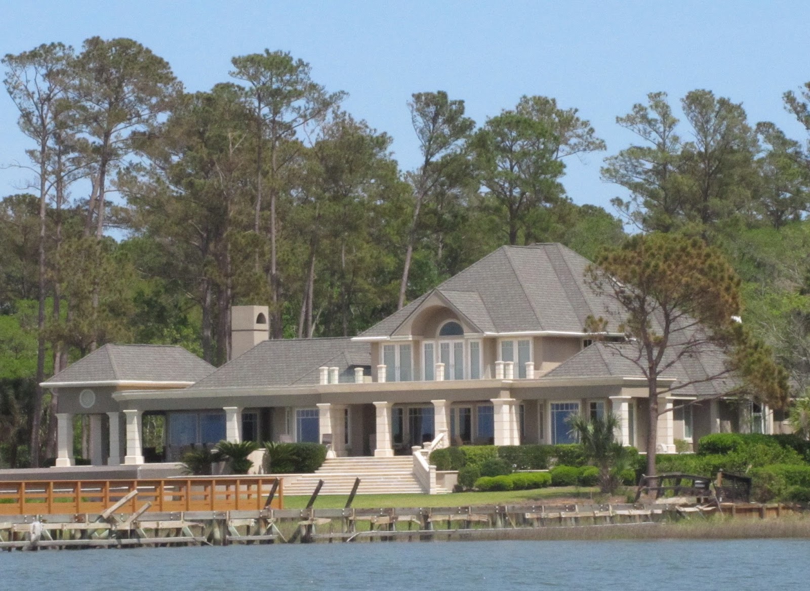
Today we cruised from Beaufort to Steamboat Creek 2, a very nice anchorage next to a boat ramp that we found with Active Captain about halfway from Beaufort to Charleston.  Baxter loves the kayak and his trips to shore, and a boat ramp is pretty much the ideal way to land him, better than floating docks that are mostly too high to get out of a kayak easily! There are theoretically four anchorages on Steamboat Creek. The first two are 4 and 3 - why anybody would want to anchor at those spots eludes us, they must not have dogs, since there is no shore access.. Anchorage 1 sounded great too but we couldn't find it!  

South Carolina ICW Shoreline
In Beaufort, Jonathan and Rosa on Salty came over from their anchorage in Beaufort Harbor on their C-Dory 22 Cruiser to tie alongside us, and we had a great visit before loading up the kayak and heading out. The shoreline between Beaufort and Steamboat Creek was uniformly marshy grass. I don't think we passed more than five or six homes along the ICW between Beaufort and Steamboat Creek. What we did pass, or passed us going the opposite direction, were three or possibly four tugs and barges. They all asserted their right to take their half out of the middle! I was too busy dodging them without running aground to take any pictures!

Along the way, we did make a phone call to a mobile boat service in Charleston to see about having the Honda BF150 serviced, since we are right at 100 hours now. Not only would it require getting the boat out of the water, the mechanic was solidly booked through the end of next week. I feel a whole lot better, though, about blowing by the 100 hour mark after talking to Pete at West Coast Marine and soliciting Bob Austin's sage advice which is always solid! Sooner or later though, we will have to bite the bullet and get the service done. The key I think will be to schedule far enough ahead. I also have not given up the thought that I can do the oil change at least without a haul-out.  The lower unit lube can probably go 200 hours, and will require a haul-out, but if we plan far enough ahead, we should be able to schedule that. Another suggestion from Jonathan was to get it done in a small town with a lot of small boats, not a big city with a lot of big boats. That probably is good advice too!

Our anchorage here is very quiet and peaceful, and taking Baxter to shore was a piece of cake. And talk about friendly locals, a lady whose husband was fishing off the dock asked if we needed groceries and offered to drive us to the grocery store! I thanked her profusely and politely declined, since we are well provisioned from Savannah!

A couple of other boats that we have heard talking on the VHF are also here across the creek from us, a Nordic Tug we think is named Black Tie and a sailboat named Escapade. We look out from our anchorage here at a very nice private dock with a little round building, possible a dock house or whatever, but it is pretty cool, whatever it is! 

Private dock and little round building
Tomorrow on to Charleston!

DAY 22 - April 22, 2017

Typical private dock
Today's cruise into Charleston from Steamboat Creek was amazing for what we did NOT see - any significant number of homes along the ICW. The homes we did see were quite modest, but they all had a private dock and boat lift. The one thing that has been a common denominator for Florida to here is FISHING! People are fishing off small boats, off bridges, off boat ramps, and off piers of every description! Today when we got here, I found some terminal tackle on the Bomar hatch on the bow! It had shrimp and bacon on the hooks as bait. To quote Jimmy Buffett "How it got there, I haven't a clue"!

Barge with crane
Tug
Some other sights along the way were a barge and tug along the shore. These are typical of what passed us yesterday going the opposite direction. When we see these guys coming, we move over and get out of the way! A lot of the barges seem to have dredging equipment or pile driving equipment. Whatever it is, you do NOT want to be in their way! There are no ordinary right of way rules here, it is the right of way of tonnage! Also these guys are not very able to maneuver, so it makes sense not to challenge them!

Daydream at Charleston City Marin
When we got to Charleston Harbor, the boat traffic was incredible! Little boats, big boats, boats going every which way. It was a challenge to dodge all the boat traffic! It was also a challenge to find the entrance to City Marina! It was considerably past where the Active Captain marker showed it, but the City Marina staff talked us in on the VHF!  We had heard the currents in City Marina made things difficult, but we did not have a problem with that. If we had a problem (and I don't really think we did), it was that it was windy as all get-out - and C-Dorys do not fare well docking in the wind! All the same, I got us in and docked. Scott from the marina caught our lines, and we got docked and tied up without any real problem!

The first thing we did was to make our Fort Sumter tour reservations for tomorrow! We will take the Fort Sumter tour at noon, get back around 2:30 p.m., and then take the horse carriage tour. We will then take a walking tour of any place that seems particularly interesting!

We decided to take the marina courtesy van into downtown Charleston to explore a little and have dinner out. We walked King Street, and found a nice little restaurant...a sushi place! Of course the South is not where you come to have sushi, but it looked good and it was, especially the Crunchy Eel Roll!  Oh yes!

Citadel Lutheran Church
The Citadel
Then we walked over to Marion Square, which is very cool.  The most famous building on the square by me is the original Citadel College. It has long since moved to another part of town, but the building is still unmistakably "The Citadel"!  Also in this square is a huge monument to Charles C. Calhoun. He was the seventh Vice President of the U.S., and a spokesman for the Plantation System and Slavery. He is evidently still revered here, for reasons that elude us. On the far end of the Marion Square is a wonderful church spire, which we believe is the Citadel Lutheran Church.

Tomorrow, showers, breakfast on the boat (Spam Eggs Benedict!) and maybe some laundry, then we take the 11:00 a.m. courtesy van for our Fort Sumter tour!

DAY 23 - April 23, 2017

Today was our day in Charleston, and we did not waste it!

I got up early and headed right for the shower, since I did not think there would be too many people lined up at 6:30 a.m., and I was right!  I then took Baxter for his morning constitutional. He has learned to pee and poop on the dock, since it is a LONG way to the grass outside the marina, and the marina has dog poop bag stations at several spots along the docks.

Our tour boat, Spirit of the Low Country
The aircraft carrier Yorktown
Our Fort Sumter tour was at noon, and we didn't have to be at the Fort Sumter Visitor Center until 11:30 a.m., so we had lots of time for coffee and a leisurely breakfast! We took the marina's courtesy van to Liberty Square, picked up our boarding passes, and soon enough we were on the tour boat Spirit of the Low Country to Fort Sumter. It was about a 30 minute boat ride. Along the way, we passed the aircraft carrier Yorktown, which has been retired to Charleston Harbor.

Fort Sumter from Tour Boat
Cannon at Fort Sumter
Fort Sumter, as pretty much everyone knows, is where the first shots of the Civil War were fired. The Confederacy had been formed but U.S. federal troops still held Fort Sumter at the entrance to Charleston Harbor.
On April 12, 1860, a warning mortar was fired by the Confederates, and then the bombardment started in earnest, lasting 34 hours. There were only 85 federal troops garrisoned at Fort Sumter, and they were divided between fighting the fires that broke out in the wooden buildings within the fort and trying to return cannon fire. The commander, Robert Anderson, realized their situation was hopeless and arranged to surrender the fort to the Confederates, who allowed the federal troops to withdraw. We learned a good deal about the Civil War and its causes. There were many rationalizations, but in the end it boiled down to the fact that the entire economy of the South and the plantation system would collapse without slave labor.

Ruins of Fort Sumter
Flags that have flown over the fort
The fort, constructed in the 1830s after the War of 1812,  today is mostly just historic ruins. A concrete battery was constructed inside the fort that remained manned through World War I and World War II, but was decommissioned shortly after World War II ended. The original exterior walls had been badly damaged, and after the Civil War ended, it made no sense to try to repair the original walls of the fort.  It is now preserved and operated by the National Parks Service, which has a museum and gift store inside the concrete battery, and NPS rangers give educational and entertaining talks on the parade ground.

Sailboats in Charleston Harbor
Ravenel suspension bridge
After about an hour at Fort Sumter, it was time to board the tour boat back to the Fort Sumter Visitor Center at Liberty Square. There were some sailboats in Charleston Harbor that caught my eye as well as the Ravenel Cable Suspension Bridge,
which the tour guide said was the second longest cable suspension bridge in the world, a claim we did not take the time to verify, but is is still a pretty impressive bridge!  This week was Race Week in Charleston and there were many sailboats large and small that were involved in the races. Two of the larger sailboats are moored near us.

Mansions on the Battery
After returning from the tour, we headed to the horse carriage tour area, where there are three or four companies that offer carriage tours. We pretty much randomly chose one that had tickets available for about an hour later, which gave us time to go Henry's on Market for a pretty darn good lunch! We asked the carriage tour folks if there were a restaurant where we could get She Crab soup, and they said Henry's at the end of the block had wonderful She Crab soup. Patty has become fond of She Crab soup, a Southern delicacy with crab roe in it, but to us, it tastes a whole lot like our old standby, Whiskey Crab Soup from the late lamented Shrimp Shack in Bellingham! The carriage tour was wonderful, and was well narrated by our carriage driver, Ben. The tour covered so much of the historic district, and we learned a lot about Charleston's original construction on marshy round, and its history of hurricanes, fires and even earthquakes. We saw many homes from the colonial and Victorian era. Probably the most impressive homes were the mansions on The Battery, which were only seasonal homes for the very rich.

St. Philips Anglican Church
St. John's Church
We also learned that Charleston's nickname is The Holy City, because of the large number of churches there. At one time, we were told, there was one church for each 14 inhabitants. Again, we did no fact checking on this! But we passed so many churches, of so many denominations, that it seems plausible! One of the attractions Charleston offered to immigrants from around the world was religious tolerance, except apparently for Catholicism! The reason for this was that Catholicism was the religion of the Spanish and French, and letting Catholics in was viewed as possibly furthering the imperial objectives of Spain and France!

Permanent shops at City Market
After the carriage tour was over, we walked across the street and had some ice cream in a little retro market, and then went to The City Market. This is a covered market that was established in 1790 and stretches for four city blocks along Market Street between Meeting Street and East Bay Street. At both ends,
there are transient vendor tables, while the central part is permanent shops. We had read nothing about this, but it turns out it is one of Charleston's major attractions. We were a bit late in getting there, and the transient vendors were mostly packing up, but the permanent shops were all open. There were crafts of every description at the transient vendor tables. Patty looked at some sea grass baskets, but they were very expensive, and so she passed!

We called the marina courtesy van from the City Market, and it picked us up about five minutes later and returned us to the marina, pretty much exhausted! We finished up the day with Facetime with Barrett and Romy in Portland and Lydia, Harper and Asher in Okanogan! All in all, a pretty great day!


Thursday, April 20, 2017

Beaufort, South Carolina!

This blog will chronicle our (Pat and Patty Anderson's) 
cruising adventures on the Great Loop!

DAY 19 - Savannah to Beaufort, S.C.

After returning our key card to the office, Andrew help us cast off and we headed to the fuel dock, where we fueled up (we calculated 5.0 statute miles per gallon, running at 2,000 RPM, which does wonders for fuel economy!) and reluctantly left this great little marina, headed for Beaufort with wonderful memories of Isle of Hope and Savannah. This is the Beaufort pronounced "Byew-furt" (South Carolina), not the one pronounced "Bow-fort" (North Carolina). We figured we had about a six and a half hour run, and so we left about 9:00 a.m.

Daydream Anchored in Beaufort Harbor
Miscalculation! What we failed to account for is that Isle of Hope is about 14 miles south of Savannah!  Add two hours at our speed! Instead of getting in at 3:30 p.m., we did not arrive until 5:30 p.m.! And as soon as we had anchored close in, right near the reeds, there was a torrential downpour! We scrambled to get the camperback all closed up! The squall soon passed and I was able to take Baxter to shore to the boat ramp by the Downtown Marina in the kayak a short paddle away from our anchorage. I took this picture from the kayak after returning from taking Baxter to shore!

But again, I get ahead of myself. The trip itself was quite interesting, not all in a good way! First off, getting out of Georgia on the ICW can be a bit of a challenge, as there are many islands and many channels.  More than once we had to stop and figure out where we were supposed to be going, even with the magenta line on Garmin Blue Chart. It actually showed up best on Garmin Blue Chart on my iPhone zoomed way out, and we saw our way clearly. We finally crossed the Savannah River and were in South Carolina! When we don't know where we are or which way to go, we stop until we figure it out!

Home on South Carolina ICW
Another Home on South Carolina ICW
I took a few pictures of some the big homes on the ICW in South Carolina, which frankly do not rival the grand homes in Florida or Georgia! I should have taken a few pictures of those for comparison, but I didn't. I think Florida and Georgia rich folk are just a bit richer than South Carolina rich folk! That is not to say these are shabby little homes, they are not, but they are just not as large and fancy as the Florida and Georgia McMansions! One thing we wondered is, why do these all these houses have chimneys? When would they ever need to burn a fire in a fireplace here, where it never gets cold?

Port Royal Sound - Sea and Sky!
The cruise was uneventful until we got to Port Royal Sound. This is a large body of water that is open to the North Atlantic Ocean. It was sort of like Bellingham Bay on a good day - pushes you around a bit but doesn't knock your fillings out! I don't want to think about what it would have been like on a bad day! There are no ICW red / green markers on Port Royal Sound except where you enter it and where you exit it. The route (the magenta line!) takes you from the entrance east directly toward the ocean until at the very last moment it turns north, and then northwest to go to the Beaufort River. It was a bit unnerving to stare directly at the North Atlantic in front of us for so long!

We finally got to Beaufort, and decided to anchor in as close to the dinghy dock / boat ramp as possible. We anchored in about 15 feet of water after checking Garmin Blue Chart tides, which told us the tidal swing would be no more than six feet. All the other boats anchored here are way farther away.

We were saddened to learn today of the passing of our good friend Karen Youngman on Easter Sunday. Karen and Lex Youngman were our good friends in the Peace Corps from training in Austin, Texas, on through our two years in Turkey. We had kept in touch ever since returning from Turkey in 1970. We visited the Youngmans in Charlotte in 2010, and were planning another reunion in Southport, North Carolina, as we progressed up the Atlantic ICW. This is now not to be, and we really will miss our friend Karen.

DAY 20 - April 20,2017

Pat and Baxter in Kayak in Fog
Today was our day in Beaufort! As usual, this morning I took Baxter to shore first thing, and it was a bit foggy when I paddled back. Patty got a nice picture of us in the fog! We decided to stay another night, because we could not possibly see Beaufort in less than a day, and we are truly glad for our decision. This is an absolutely delightful place, full of history and charm! What better way to see it than by taking a horse carriage tour? We bought our tickets and had a little time to walk around before our carriage ride.


Rhett House
St. Helena Anglican Church
We walked, on recommendation of the lady in the Marina Ship's Store, to the St.Helena Anglican Church, and on the way to the church, we passed the Rhett House. The Rhett family goes way back in Beaufort history, and Rhett descendants still live here today!  We later leaned from our tour guide on the horse carriage ride that Margaret Mitchell was inspired to create Rhett Butler from composites of the Rhett family of Beaufort and the Butler family of Atlanta for Gone with the Wind.  The church was closed but we strolled around the St. Helena cemetery. We saw some of the Rhett tombstones in the St. Helena cemetery, along with a lot of other tombstones with dates that just boggle the mind, coming from the Northwest where 1850 sort of marks the beginning of modern settlement.

On the way back from our walk, I was taken by the moss in the live oak trees. It made me think of the Don Williams song Good Old Boys Like Me, "I can still hear the wind in the live oak trees...and those Williams boys, they still mean a lot to me, Hank and Tennessee..."

Moss in the Live Oak Tree

Our horse carriage
Angus
When we got back from our walking tour, we had only a short wait for our horse carriage tour. We were on the Sea Island carriage tour. There are several different horse carriage tour companies but they all sell tickets from the same ticket booth and start from the same location in front of the marina. There is a very cool watering trough that the horses all drink from between their tours. Our horse was "Angus," and a fine horse he was!

We went by a great many fine homes dating from the 1700s and 1800s. There are very strict Historic District regulations here, but they only date from the 1970s, so whatever damage was done to the Historic District, mainly incongruous 1970s era homes, remain today. As in Savannah, the tour folks thought it would be interesting to tell us which movie stars stayed in which historic homes for which movies - which it actually was not, except for the Barbara Streisand story.  Barbara was here making The Prince of Tides. She was offended by the frequent jet plane fly-overs from the three nearby airbases (Parris Island is near here, where the Marines train). She actually called the Commander demanding that he change the schedule for the flights! He instead ordered especially low fly-overs over the house in which she was staying! Here are a few of the historic homes.


After the carriage tour, we had a wonderful lunch at Panini on Main Street, and then returned to Daydream. While we were having our sundowners, we heard a horn honk and looked over to see our friends from Honest John's Fish Camp, Jonathan Arthur and Rosa Cross on Jonathan's C-Dory 22 Cruiser Salty! They had left Melbourne Beach, FL, on the 18th, and had done a couple of 100+ mile days and here they were in Beaufort on the 20th! By contrast, we had left Melbourne Beach on the 7th and got here only one day earlier than they did!, Tomorrow we motor off for an anchorage as unknown, but we will be in Charleston on the 22nd, with reservations for City Marina for two days!  Stay tuned, the next installment may be tomorrow or in three days, who knows!

Salty Anchored in Beaufort Harbor

Jonathan and Rosa on Salty


Tuesday, April 18, 2017

Isle of Hope Marina and Savannah


This blog will chronicle our (Pat and Patty Anderson's) 
cruising adventures on the Great Loop!

DAY 17 - April 17, 2017

We left our terrific anchorage on Walburg Creelk about 8:30 a.m.  We had made coffee and put it in the thermos the night before to save time, and I took Baxter to shore at first light. We had our toast and coffee, weighed anchor and headed out! It was an easy cruise to Isle of Hope Marina, which is right on the ICW in Savannah.

Isle of Hope Marina
We were tied up at Isle of Hope Marina around 1:00 p.m.  Kimberly promptly answered our VHF radio call and directed us where to go.  Andrew from the marina was on the dock to take our lines, help us pivot the boat, secure our lines, and get our shore power connected.  This marina does not have conventional slips but long floating docks, and all boats are side tied - different from what we are used to, but it seems to work great here. We went up to the office, where Kimberly registered us, gave us our key card, and reserved one of the the loaner cars for us for 3:00 p.m.  We also reserved the car for 8:00 a.m. tomorrow, since we were pretty sure we could not get everything done we needed to do in the two hours we had the car today! This is a great marina, and we highly recommend it. The staff is friendly and helpful, and the facilities are clean.

Today was about taking care of business! We looked up the addresses of the Verizon store to buy a Jetpack, the One Stop Wireless store to buy a "gently used iPhone," the T-Mobile store to get a new T-Mobile SIM card, and the West Marine store to get a male 30 amp to female 20 amp straight connector - we are now using 30 amp to 15 amp connectors on both ends of a heavy duty extension cord for shore power, as nothing on this boat requires 30 amp service anyway.

These stores were all on Abercorn Street, which it turns out is Savannah's "Main Street," and within a few blocks of each other. We actually passed a closer Verizon store, stopped in, and bought the Jetpack and a 5 GB per month data plan - we will use our T-Mobile iPhone Personal Hotspots when we have T-Mobile service, and the Jetpack when we don't. Saying T-Mobile is "sketchy" around here is being generous - too many places our T-Mobile iPhones say "No service." I got a great deal on a 32 GB iPhone 5C (same as the 5S but without fingerprint recognition, which I hated anyway), and the guy at the T-Mobile store plopped in a new SiM card, and I was back in the iPhone business! The 30 amp to 20 amp connector was outrageously priced at West Marine, as is everything. We call it "The Bank of West Marine, where you only make deposits"!

When we got back to the marina, we did our laundry and had a bite to eat. We were all in, so it was an early night!

DAY 18 - April 18, 2017

Old Town Trolley
We had the loaner car from 8:00 a.m. to 11:00 a.m., since we needed a significant re-provisioning trip! There is a Kroger supermarket a couple of miles away from the marina, and we got up early enough to get the car promptly at 8:00 a.m. We hoped we would get our shopping done sooner, since today was our day to tour Savannah, and we did - we were back at the marina around 10:00 a.m.  It took a bit to put our groceries away, and then we needed to get to Savannah for the tour, since Patty had purchased Old Town Trolley tickets online. Old Town Trolley is like the Red Train in St. Augustine, in fact Old Town Trolley operates in St. Augustine as well. Both trolleys allow you to get on and off at designated stops as many times as you want to, and another trolley comes around each designated stop about every 15 minutes.  It has turned out to be a great way to sight-see a new city.

But first we had to get from the marina to downtown Savannah! Uber to the rescue! We took Uber both ways, for a measly $14 and change each way - no wonder the taxi companies hate Uber! Both ways it took the Uber driver less than 10 minutes to arrive to pick us up! We are big Uber fans now!

Oglethorpe's Plan for Savannah
In 1732 James Oglethorpe received a charter from King George II to found the new colony of Georgia between Florida and South Carolina. Oglethorpe and 113 other colonists arrived in 1733. Oglethorpe and William Bull laid out the plan for Savannah.

Statue of Haitian Soldiers in Revolutionary War
The plan was based on "wards," consisting of eight blocks, with a public square in the center. This pattern was originally established for four wards/squares, and by 1851 had grown to 24 wards/squares, all with the same repeating street pattern. Over time, two squares were "lost," so today there are 22 wards/squares. Each square now has a monument of some kind surrounded by a grassy commons. The monuments run the whole gamut of the history of Savannah.  One interesting one commemorates Haitian soldiers who fought against the British in the Revolutionary War. These soldiers later led the Haitian effort to break free from French colonial rule, and one of them became the first King of Haiti.

SCAD sign
The tour driver pointed out dozens or hundreds of houses and buildings, houses where this or that famous person lived or a movie was shot or something else happened. I did not take pictures of these because a picture of a house, even a nice old house, is just a picture of house, and the real interest is in
who lived there or what happened there. But Savannah is a model of historic preservation, and along with the Historic Savannah Foundation, the Savannah College of Art and Design (SCAD) has been a major force in the preservation of historic Savannah.  SCAD owns and has renovated more than 70 major historic buildings in Savannah. So I took a picture of the SCAD sign so I would at least have some pictures!

Patty's Cucumber Cooler
We had lunch at City Market, a two block pedestrian mall much like St. George Street in St.Augustine. We chose the City Market Cafe. although there are many, many choices at City Market. Patty started out with a Cucumber Cooler, basically Pinot Grigio with cucumbers, lime and club soda.  I had a local Savannah wit beer, which was pretty good too. I had Creole Shrimp over Grits with Collard Greens and Patty had Crab Stuffed Mushrooms with Spinach and a side of Grits. Lunch was good, and we can recommend the City Market Cafe if you are ever in Savannah!

McDonalds Walk-up Window
After lunch we decided to head for River Street, but first I went over to the next block to McDonalds. This is not your average McDonalds, it is in the heart of the Historic District, and has no drive-though lanes. As far as anybody knows this is the only McDonalds in America with a walk-up window. The person at the walk-up window was kind enough to pose for a picture. Patty pooh-poohed mythought that this was unique and interesting, but I took the picture anyway! I thought is was kind of cool.  And it shows that corporate America does not dictate to a city how it will do business - nothing go torn down to build this McDonads, and there are no huge Golden Arches. Score one for historic preservation!


Ballast Rock Wall and Stairs
Factor's Walk
We caught the next trolley to River Street, which was interesting to me for two reasons. First, the street down to River Street is constructed of ballast rock, which are rocks that served as ballast on ships coming to Savannah, then the the ballast rock was unloaded to make room for the cotton bales or whatever else was getting shipped back to wherever the ship came from, and ended up being used to build these streets. Second, this is where the "factors," who were the cotton brokers, would survey the cotton going to the dock from a "Factor's Walk," a bridge between two buildings underneath which the loads of cotton would pass, so the factors could grade and price the cotton,  There are warning signs on the stairways made from the ballast rock, and the streets themselves test the suspension of the cars that drive over them!

Savannah is a very historic and interesting city, and we are glad we had a chance to see it! Tomorrow we move on to South Carolina, first to Beaufort, and then to Charleston! Stay tuned!